
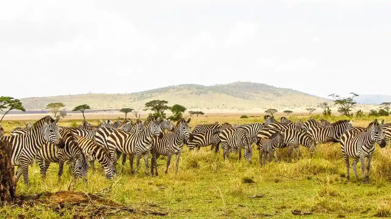


Lemosho Route 7 Days
The Scenic Lemosho Route – 7 Days
The Lemosho Route is Kilimanjaro's most scenic and remote trekking path, offering the perfect blend of natural beauty, solitude, and excellent acclimatization. Starting from the western side at Lemosho Gate, this route traverses through pristine rainforests, crosses the spectacular Shira Plateau, and merges with the Machame Route for the final ascent to Uhuru Peak.
What makes Lemosho truly special is its combination of remote wilderness and reliable infrastructure. The 7-day option suits experienced trekkers with strong fitness levels, offering a well-paced ascent through diverse ecological zones. With careful "climb high, sleep low" scheduling and expert guide support, summit success rates reach approximately 90%. Unlike busier routes, Lemosho offers genuine solitude with fewer climbers and pristine natural scenery at every turn.
The route showcases Kilimanjaro's full ecological diversity: starting in lush rainforests teeming with colobus monkeys and exotic birds, ascending through moorlands with giant lobelias and groundsels, crossing the stunning Shira Plateau with panoramic views, ascending the famous Barranco Wall with 360-degree vistas, and finally reaching the glacial summit zone. You'll experience expedition-style tent camping with expert guides, quality equipment, and authentic mountain adventure.
Is Lemosho Right for You?
- Most scenic and remote route. Pristine wilderness with fewer crowds than other routes
- Spectacular Shira Plateau crossing. Stunning panoramic views and unique geological formations
- Excellent acclimatization with highest success rates. 90-95%+ on 8-day option
- Diverse ecosystems. Rainforest, moorland, Shira Plateau, alpine desert, glacial zones
- Famous Barranco Wall experience. Thrilling 230m scramble with 360° panoramic views
- Authentic expedition experience. Quality tent camping with expert guides and full support
- Solitude and natural beauty. Fewer trekkers means more intimate mountain experience
- Tent camping only. Requires comfort with expedition-style accommodation
- More challenging than Marangu. Requires good fitness and mountain experience
- Longer duration (7 days) vs 5-6 on Marangu route
- Higher cost. More days and remote location increase expense vs shorter routes
- Barranco Wall scramble. Thrilling but not for those uncomfortable with exposure
- Remote location. Limited emergency evacuation options compared to Marangu
Lemosho Route on the Map
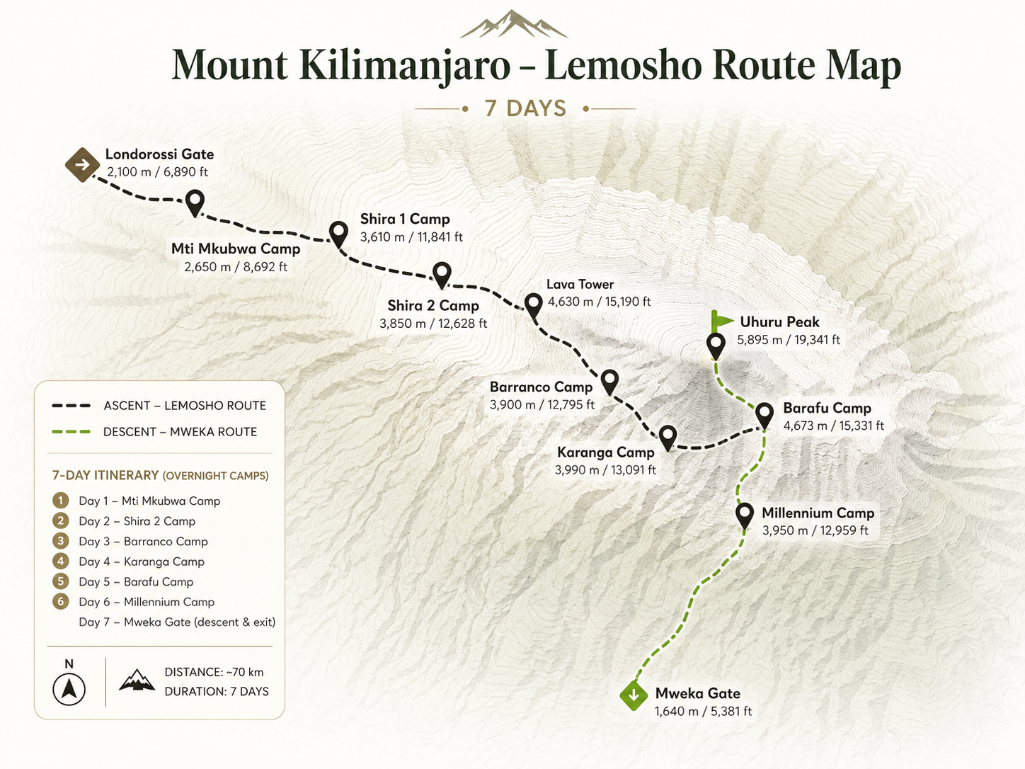
Visual Guide
Elevation Profile
Route Itinerary
After breakfast in Moshi, you drive west to Londorossi Gate to complete park registration, then continue to the Lemosho trailhead. The route begins in quiet, remote rainforest where few other groups walk, and colobus monkeys may be seen in the trees. After a few hours on the trail you reach your first camp, where your crew has set up the tents.
Guide's note Hold back on the first day, even if you feel strong. The slow pace through the forest is deliberate, and it pays off higher up the mountain.
The rainforest gives way to giant heathers and moorland as you climb onto the Shira Plateau, an ancient collapsed volcano. The views open up across the high plateau towards Kibo, the summit cone. You walk at a deliberately slow pace and reach Shira Camp in the afternoon. Your guides check your health and oxygen levels every evening.
Guide's note As the views open up, take short breaks to look back down the mountain. Keep sipping water steadily through the day, even when the air feels cool.
A key acclimatisation day. You cross the Shira Plateau and climb to the Lava Tower, a volcanic rock formation at around 4,600m, where many people first feel the altitude. You then descend into the Barranco Valley, with its giant groundsels beneath towering cliffs, to sleep at Barranco Camp. Climbing high and sleeping lower helps your body adapt.
Guide's note Lava Tower is often where climbers first feel the altitude. Tell your guide about any headache; descending to sleep lower at camp tonight is exactly what helps the body adapt.
The day begins with the Barranco Wall, a steep scramble where you sometimes use your hands on the rock. It is not technical climbing, and your guides help at the trickier steps, but a head for heights is useful. From the top you enjoy wide views of Kibo's glaciers. The trail then crosses several valleys to Karanga Camp.
Guide's note The Barranco Wall looks daunting from camp but is a scramble, not a technical climb. Keep your hands free, use the holds your guide shows you and take your time on the narrow section known as the kissing rock.
A steady climb over increasingly barren, rocky ground brings you to Barafu Camp, the base for the summit attempt, on an exposed ridge. You arrive around midday, eat an early dinner and rest in the afternoon. Your guides check your health and prepare you for the summit night, making sure your clothing, headlamp and water are ready.
Guide's note The afternoon at high camp is for rest. Check your summit layers with your guide, eat a good early dinner and try to sleep, even if only for a few hours.
You start around midnight, climbing by headlamp up the steep scree slope towards Stella Point on the crater rim, which most climbers reach around sunrise. From there, conditions and your health permitting, you continue to Uhuru Peak, the highest point in Africa at 5,895m. After photographs you descend to Barafu for a rest and then continue down to Mweka Camp for the night.
Guide's note Summit night is a slow, steady climb in the dark and cold. Follow your guide's pace, keep snacks and water close to your body, and remember that turning back is always a sound decision if your guide advises it.
After breakfast you descend through the rainforest to Mweka Gate. The trail can be muddy and steep in places, so take your time. At the gate you receive your summit certificate and say goodbye to the guides, cooks and porters who made the climb possible, before driving back to Moshi for a hot shower and a well-earned rest.
Guide's note The descent is hard on the knees, so poles and short steps help. It is also the moment to thank the crew: the farewell and tipping at the gate is a warm, lively end to the climb.
the shape of the climb
How this climb unfolds
Lemosho begins on the remote western side, in quiet forest, and crosses the whole width of the Shira Plateau before joining the southern circuit at Lava Tower and Barranco. The summit attempt is from Barafu, with the descent by Mweka.
It is one of the most beautiful routes on Kilimanjaro, with few climbers for the first days and a gradual profile. Seven days works well for fit hikers; the eight-day version adds a day at Karanga for even better acclimatisation.
zone by zone
The mountain on this route
The summit is the goal, but the mountain is the journey: the forest, the moorland, the stars over camp. Enjoy every day of it.
From our mountain crewbefore you go
Preparing for the climb
other ways up
Related climbs

Lemosho Route, 8 Days
View this climb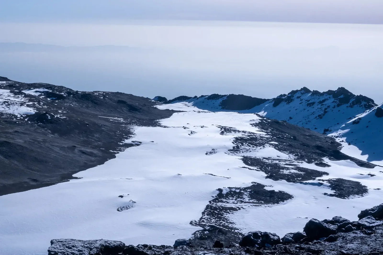
The Lemosho Route
View this climb
Machame Route, 7 Days
View this climbplanned around you
Plan this climb with us
Tell us your preferred dates, group size and any previous experience at altitude. We will confirm the route, crew and hotel nights, and send a clear, personalised quote that lists exactly which park fees, equipment and transfers are included.
Overnight Stops
| Camp Name | Altitude | Zone | Night | Notes |
|---|---|---|---|---|
| Lemosho Camp | 2,650m | Rainforest | Night 1 (both) | Expedition tents; rainforest setting; colobus monkeys & birds; communal dining |
| Shira Camp | 3,850m | Shira Plateau | Night 2 (both) | Expedition tents; stunning plateau views; Kibo & Mawenzi visible; health checks |
| Barranco Camp | 3,976m | Alpine Zone | Night 3 (both) | Expedition tents; beneath Barranco Wall; acclimatization hiking; scenic vistas |
| Karanga Camp | 4,035m | Alpine Zone | Night 4 | Expedition tents; acclimatization day ; pulse oximetry checks; final preparation |
| Barafu Camp | 4,673m | Alpine Desert | Night 5 | Final camp; expedition tents; midnight departure to summit; health checks & equipment prep |
| Uhuru Peak ⭐ | 5,895m | Arctic Zone | N/A | Africa's highest point; glaciers & crater; Gilman's Point (5,681m) on rim; sunrise summit |
| Mweka Camp | 3,068m | Forest Zone | Night 6 | Expedition tents; forest setting; descent day rest; celebration with guides & porters |